Turn your hometown, a mountain range or your neighbourhood into a model for 3D printing. Add your own GPX route, choose the shape, size, colours, frame and lettering, or assemble large wall art from smaller tiles. Buildings, bridges and trees use available map data, with more detailed sources in Czechia and Slovakia. Preview your model and download STL or colour 3MF for free to print on your own printer.
Choose a town, mountains or your neighbourhood. Add a GPX route, personalise the shape, colours, frame and lettering, or assemble large 3D wall art. Preview your model and download free STL or colour 3MF for your own printer.
Gallery: 3D models of towns and landscapes from the map
Start with our recommended places, or explore the categories for more. Preview a model, adjust its colours and size, and download it for your own printer.
No published models yet.
YOUR PLACES AND INSPIRATION
Favourite places and saved maps
Your private maps in one place, alongside public inspiration from others. Reopen your saved settings, adjust them and prepare your model for printing.
No maps from users yet. Save your own map in your account and offer it to Favourites.
Want to share a map with others? Choose “Offer for public sharing” in My account. It will only become public after approval.
WHAT'S NEW
mapSTL.com news
New features, clearer controls and improvements to your 3D maps. We add updates here as we improve the website.
Create your map right on the homepage
The map builder is back on the homepage. Find a place and personalise your model on one page. News and gallery inspiration are below the builder. A divider and heading mark the start of the builder, with a reminder that downloads are free and no account is needed.
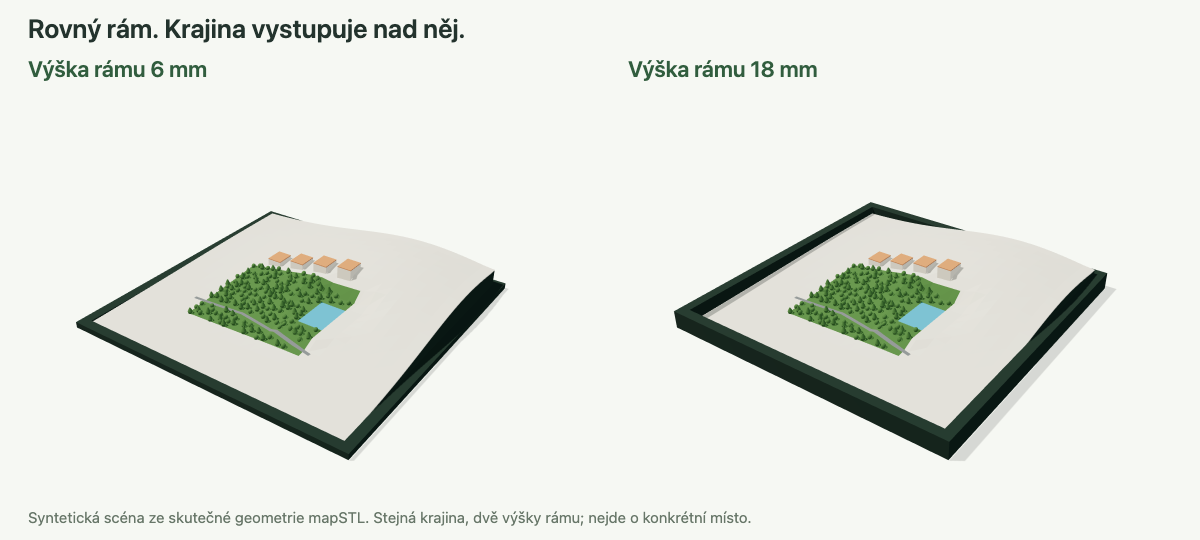
A level frame at your chosen height
Set the frame height from 3 to 100 mm in Frame and text. Its top edge stays level around the entire perimeter, while the landscape can rise above it. Height is measured from the bottom of the frame, including the backing of a separately printed frame.
Actual generator geometry in a synthetic scene. Frame height changes while the landscape stays the same. This is not a real location.More about this update
Available for square and circular maps and tiled wall art. Wall art has a frame only around its outer perimeter, with adjacent pieces meeting at the same height. Print the frame with the map or separately for inserting and gluing. Regenerate the model to apply the change.
Quickly choose the ground area size
Alongside the slider and manual input, a dropdown now offers common sizes from 200 m to 200 km. All three controls stay in sync and the map selection updates immediately. For wall art, this sets the entire selected area; the print size in centimetres stays unchanged.
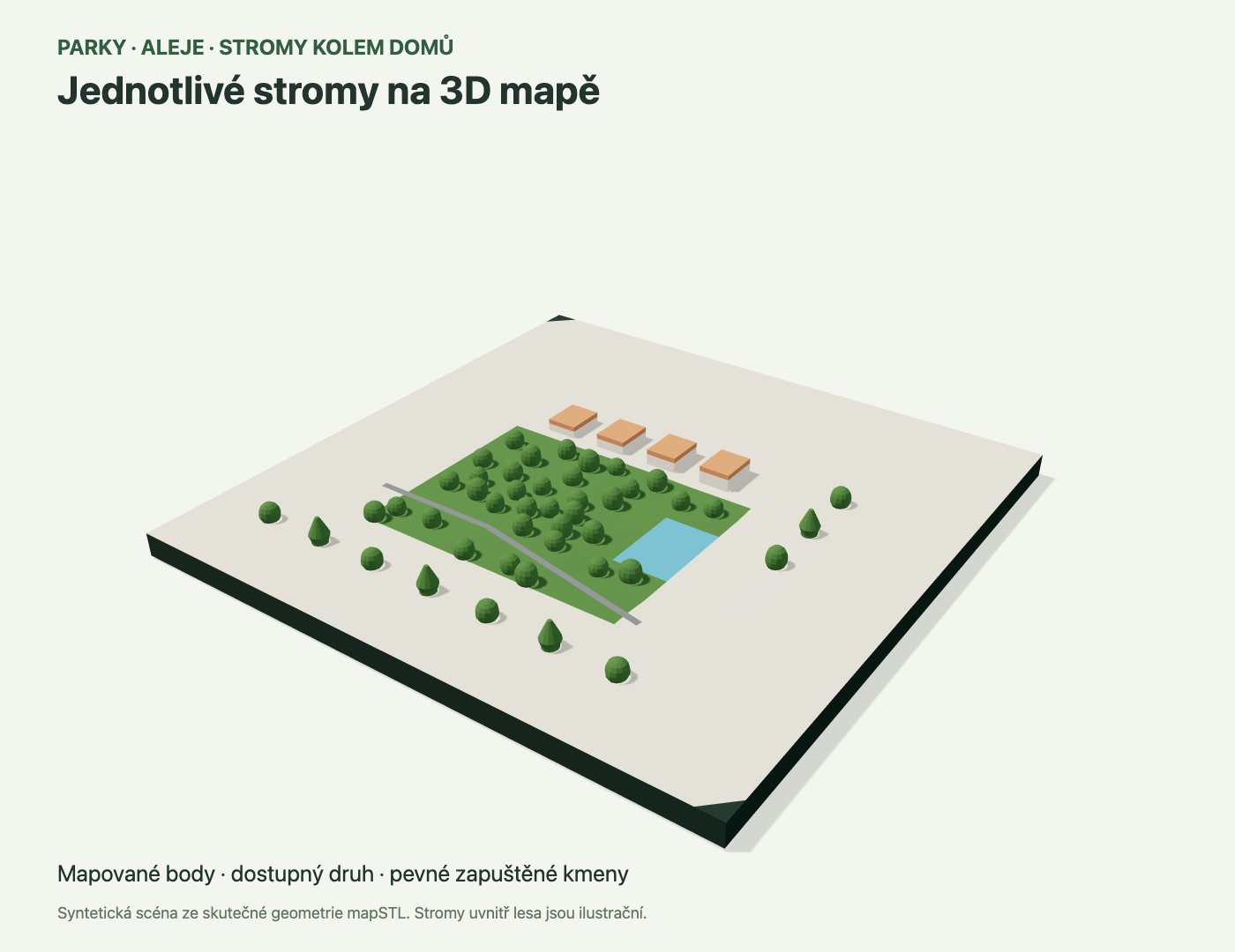
Individual trees at their mapped positions
Models in Czechia and Slovakia now also include individual OpenStreetMap trees, for example in parks, avenues and around buildings. Available leaf information or a recognised genus determines a broadleaf or conifer shape. When this information is missing, a generic rounded crown is used. Mapped trees take priority over illustrative forest trees.
Synthetic scene rendered from actual generator geometry. The row of individual trees uses supplied points; forest trees are illustrative additions. This is not a real location.More about this update
Trunks are reinforced for the selected nozzle and embedded in the terrain; crowns avoid horizontal overhangs and sharp tips. Dimensions are adapted to available data and printing. Close spacing, collisions with roads or buildings, and unsuitable slopes can cause a tree to be omitted. Positions are never moved. This is not a complete tree inventory or a botanically exact model. Check the layer preview in your slicer before printing.
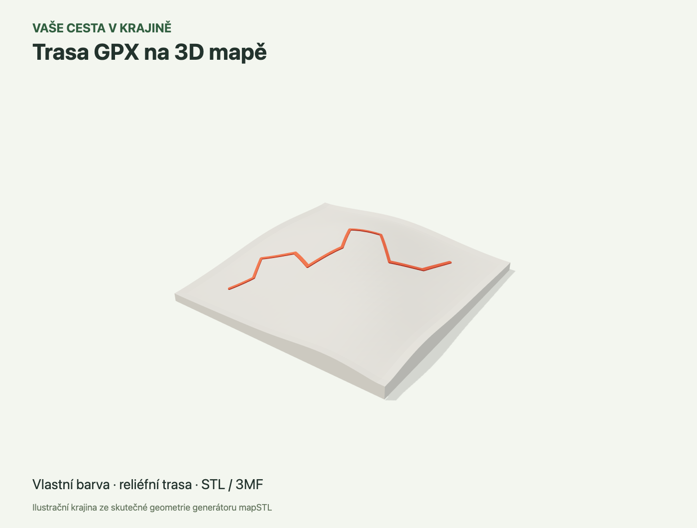
Your GPX route on a 3D map
Turn a bike ride, running loop or mountain trip into part of your print. In Place, open Your GPX route and upload a recorded track or planned route. It appears on the map immediately, with the selected area fitted around it. Choose one of the model’s filaments and adjust the printed width. The route is raised in monochrome STL and has a separately named part in 3MF. It also continues across picture tiles.
Illustrative terrain and route rendered from actual generator geometry. This is not a recording of a real trip.More about this update
The longer ground side can now reach 200 km. Large areas over 8.5 km use terrain only; select a smaller area for buildings, water and roads. Circles and municipal boundaries clip the route. Route elevations follow the model rather than the GPS altimeter. GPX is read in your browser; saving a project or placing an order also saves the route. Files may be up to 10 MB; split very long or complex recordings into shorter sections.
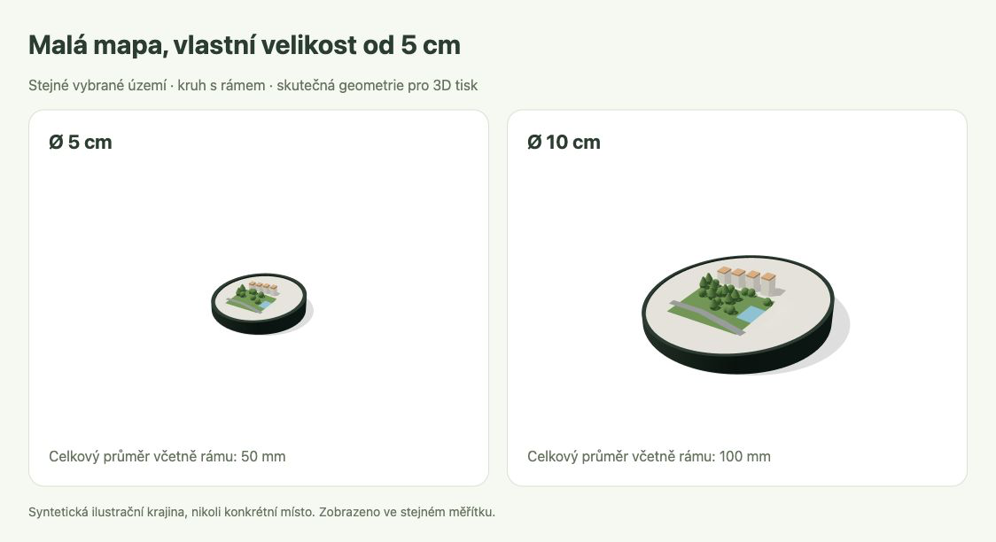
Small maps starting at 5 cm
Create a single map starting at 5 cm. In Dimensions, choose Custom and enter a size between 5 and 40 cm in 1 mm increments. For circles, this is the diameter; for squares, the side length. The size includes any frame.
Synthetic illustrative landscape using actual generator geometry. Both models show the same ground area and are displayed at the same scale.More about this update
Small models can be downloaded as STL or colour 3MF. Fine features still adapt to the selected nozzle, so a smaller print may contain less detail. Tiled picture presets still start at 10 cm per tile.
MY ACCOUNT
Your places stay with you.
MY ACCOUNT · ADMIN
Production and management
Your maps and colours, customer orders and website settings in one place.