

Slovensko · Šútovo
Šútovo Waterfall and Valley
A wooded Malá Fatra valley with steep enclosing slopes and a prominent waterfall step.
Explore this placeCheck your connection and try loading again.
Retrying the page once automatically…
FROM MAP DATA TO YOUR PRINT
Where your model data comes from, how accurately it represents a place, and the conditions for sharing and printing it.
Map data © OpenStreetMap contributors, ODbL 1.0 licence. The map is used to choose the area. For selections up to 8 km fully covered by our stored regional extracts, buildings, roads, water, forests and railways come from Geofabrik extracts hosted on mapSTL.com. Databases, timestamps, coverage and the ODbL licence are publicly available. Outside that coverage, the browser automatically reads the selected area from Overture Maps open data. Whole-country downloads are not required. Czechia and Slovakia keep their detailed local sources. Detailed Czech and Slovak terrain is complemented by global Mapzen Terrain elevation tiles. The browser downloads only data for the selected area. Named towns, landmarks, peaks, streets and other places in Czechia and Slovakia are searched in our local OpenStreetMap index (ODbL 1.0, database downloads). Other addresses and places worldwide are searched through Photon. The data is a snapshot, not a live map. Public supplementary services come with no availability guarantee.
Wikidata (structured data under CC0) supplements worldwide search with Czech and English names, aliases, descriptions and reference coordinates. We offer entries with usable coordinates on Earth. Czech names and coordinates are not available for every place. The reference point of a large area may not mark its most interesting part; adjust the selection on the map.
For fully covered selections we automatically try ČÚZK DMR 5G (numeric service with a 2 m raster) and ÚGKK SR DMR 5.0 (GKÚ Bratislava / VÚGK service, 1 m raster, ALS 2017–2022). The services do not provide a survey date for the particular selection; download time is not survey time.
The Czech service uses Bpv heights; the Slovak service uses ETRS89/GRS80 ellipsoidal heights, labelled separately in the preview. We do not mix vertical systems inside one selection. If national data are unavailable or incomplete, a labelled Mapzen fallback is used for the whole selection. If that source is also unavailable or fails validation, generation stops with an explanation; missing mountains are not replaced with a flat plane. The model grid has at most 256 intervals per axis: source resolution is not the resolution of the whole print. Detailed terrain does not include roofs or complete bridge structures.
Exports preserve the selected source, licence and available time information. Changes include cropping, resampling, relative heights, water conditioning and generalisation for printing. Approaches continue across connected road segments; where usable structure data is unavailable, heights are estimated.
For covered Czech selections up to 8 km, we add ČÚZK DMP OK. The surface, originally sampled at 0.5 m, is resampled to at most 1,024 intervals per axis and used inside building footprints. Roofs follow the measured surface; vegetation and different survey dates can affect the result. Small roofs or unusable values fall back to mapped attributes and simplified geometry.
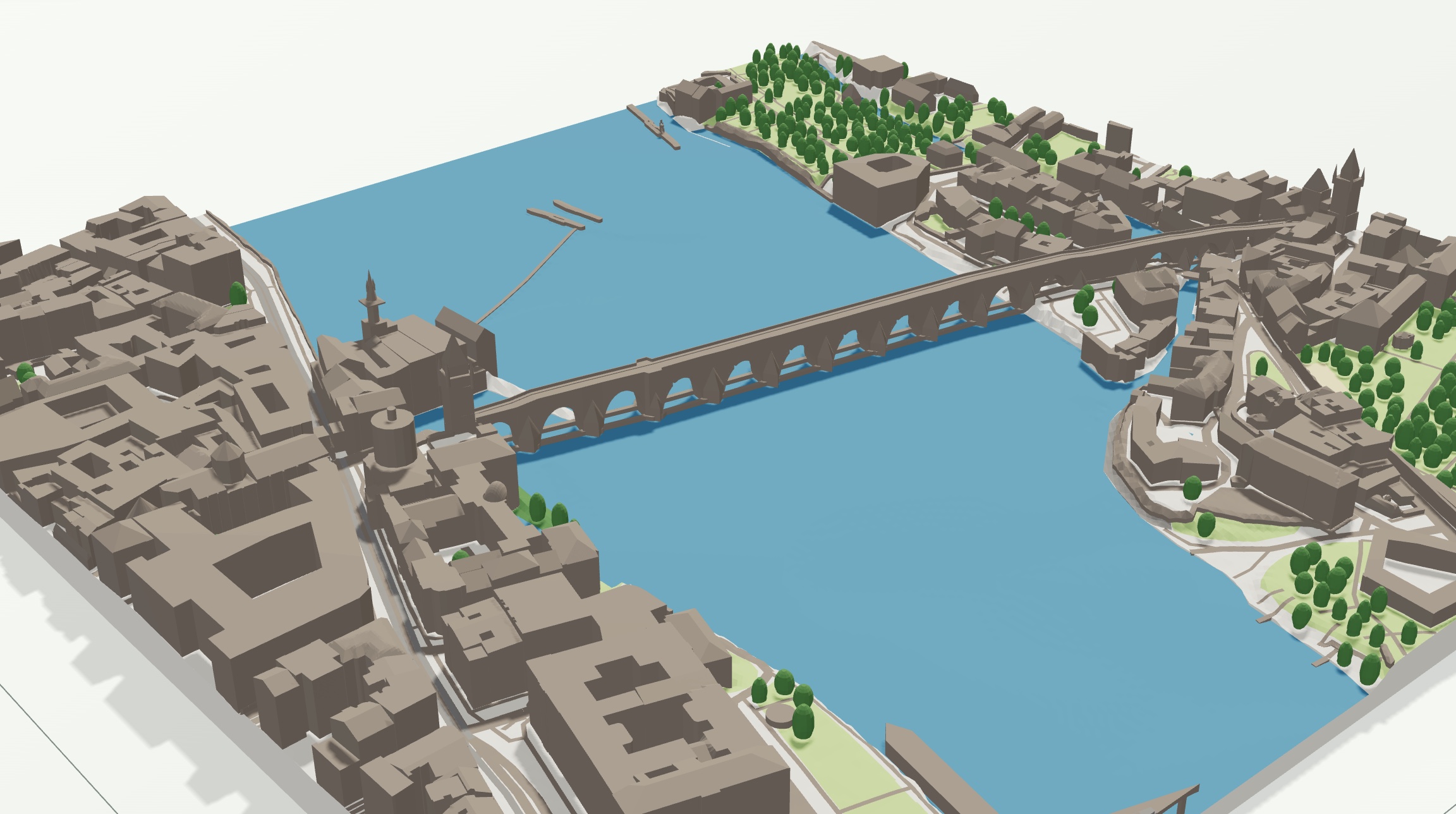
In Prague we use available IPR Prague 3D bridge structures, source data © IPR Praha. Upper and lower surfaces are reconstructed as closed solids. Arches and piers are retained at printable resolution; small vertical details and overlapping components may merge. Heights are checked against DMP before use. Exports preserve attribution, licence and modifications. This is not a current engineering survey.
Outside available IPR structures, DMP may improve a bridge deck profile, but not its underside. Gabled, hipped, pyramidal and skillion roofs also follow explicit OSM attributes; missing heights remain estimates. This includes Slovakia, whose measured roof surface is not connected yet. Models report the actual source counts and any fallback to simplified geometry.
The municipal area option uses the entire municipality from ČÚZK RÚIAN, including all its cadastral units. Individual parcel boundaries are not displayed. Boundaries are transformed to WGS84, simplified and modified for 3D printing. Scale and printing limit detail; the model is not a land surveying document. The selected boundary version is retained in the model configuration and attribution in exports.
A finer triangle mesh does not add details the source data lacks. Buildings come from the footprints in the map; the height is estimated when no value is available. Crowns are simplified shapes based on mapped trees, woodland and available satellite cover; they are not an exact inventory of real trees. The colour parts of the 3MF need to be assigned to filaments in your slicer. mapSTL.com does not guarantee the fidelity of every roof, tree or road.
In prepared areas, Copernicus Woody Vegetation Layer 2021 supplements vegetation cover (original 5 m raster). We use the available area of the V01_R03 European mosaic for EEA38 and the United Kingdom, including Czechia and Slovakia. Coverage follows valid source cells, not every location in Europe. Satellite-added crowns use Copernicus Dominant Leaf Type 2021 (10 m) to refine their type. In “From map” mode this identifies the dominant broadleaved or coniferous type, not individual tree or shrub species. Explicit map attributes take priority. WVL cover is preserved wherever leaf type is unknown. It includes trees and shrubs; crowns are stylised and do not describe the actual tree count, trunk positions or heights. Small patches can be missed. Missing cells are not treated as observed absence. Existing map sources remain in use outside available coverage or when the limit of 64 tiles / 4 MB is exceeded.
Prepared files are served by mapSTL.com; generation does not trigger downloads from Copernicus. © European Union, Copernicus Land Monitoring Service, European Environment Agency (EEA). The Copernicus full, free and open data policy allows commercial use and redistribution with source attribution and modifications identified. Modifications include cropping, nearest-neighbour reprojection to WGS84 and print generalisation. Exports retain the source and revision. No official EU endorsement. The reference year 2021 does not describe present-day vegetation.
The ZIP includes ZDROJE.txt and a printable STITEK.html. A 3MF includes attribution in its metadata and mapSTL/zdroje.txt. For a standalone STL, also use Download attribution TXT and Download attribution sheet in the export menu. Preserve attribution on packaging and at the point of sale, and where practicable on the item or a label, including the readable address openstreetmap.org/copyright. Source providers do not endorse the modified model.
A data licence does not automatically clear copyright in depicted architecture or artwork. A free download is not permission for every further use. The work, intended use and applicable law must be considered; scale or customer selection alone does not settle these rights.
mapSTL.com provides free digital models and does not provide printing. Exporting a model does not clear rights to every depicted work. Assess any rights in specific buildings or works for your intended use.
The generator and STL / 3MF exports are free for schools, universities and individuals. Contact us in advance about capacity for a larger project. Bulk automated downloads and circumvention of service limits are not permitted.
These rules govern access to the service; they do not change open-data licences or the rights they grant. ODbL and CC BY permit commercial use subject to their conditions. We therefore do not claim that mapSTL.com has an exclusive right to sell all map prints. Rights in particular buildings or other works must be assessed separately.
Each source has its own licence; we do not assign one licence to the entire combined model. Its attribution file identifies the specific sources.
The map switch uses Czech orthophoto © ČÚZK when zoomed in in Czechia and EOxCloudless by EOX IT Services GmbH worldwide (Contains modified Copernicus Sentinel data 2016). Both layers are available under CC BY 4.0. The worldwide mosaic has approximately 10 m resolution and does not show current conditions. Imagery loads from public map services without an availability guarantee; the browser scales and projects it onto the map. It is a background for selecting a place only: we do not derive 3D geometry from it or include it in STL or 3MF.
Map data © OpenStreetMap contributors, ODbL 1.0. Preserve attribution and comply with applicable derivative-database obligations. ODbL is not interchangeable with CC BY; a file extension alone does not determine the status of an output. Our derived regional databases from Geofabrik, snapshots and modifications are available for download.
CC BY 4.0 permits commercial use subject to its conditions. Modifications include cropping, resampling, relative heights, reconstruction, scaling and print generalisation; boundaries are transformed and simplified. Retrieval dates are not survey dates. Unknown survey dates are not invented.
Global tiles provide relief outside national coverage and serve as a labelled fallback. Elevations become relative relief at print scale; this is not a survey of an individual summit.
Mapzen Terrain Tiles is a combined dataset. Individual tiles may use different sources; per-sample provenance is unavailable, so the aggregate attribution is retained. Each source has its own terms. Provider documentation; downloadable attribution.
The notices below accompany distributed software. Software licences do not settle rights in data or depicted works.
Open licences do not guarantee unlimited downloads or service availability. Data and map services have their own policies in addition to the data licences.
Worldwide models use buildings, transportation, water and land use under ODbL 1.0. Land cover uses CC BY 4.0. Both licences permit modification, 3D printing and sales of prints subject to their terms. Retain the full source sheet and links; retain author credits and modification notices for CC BY 4.0 contributors too. The data licence does not clear architectural rights in a specific model. The separate model rights review still applies.
Full contributor credits · Published derivative database modification method (ODbL) · Official Overture licences
Only selected byte ranges of original GeoParquet are read from public AWS/Azure storage. No demonstration PMTiles, paid service or account is used. Overture does not supply exact roofs or bridge structures everywhere; worldwide models use simpler geometry. Additional libraries: hyparquet 1.31.4, fzstd 0.1.1 and polygon-clipping 0.15.7 (MIT). Their notices and dependency notices are included in the published worker bundle.
The only public preset is OpenStreetMap Richer, a richer custom mapSTL colour scheme. It is not an official OpenStreetMap style. Water #3d8fb5, forest #4f8a4b, meadows and parks #a9d27a, buildings, roofs and roads #8f8379, base and other ground #e9e5da, snow and ice #ffffff, rock and railways #8c8a88, sand #e8d9a0. Users keep their custom colours and saved palettes. The colour scheme does not change the sources or licences of map and elevation data.
Within the continental United States service area, the application requests a small numeric crop from USGS 3DEP. These USGS-produced data are public domain; credits and modifications are retained. Actual coverage is checked, and the global Mapzen source is used if coverage is incomplete or the service is unavailable. No location-specific raster is stored on mapSTL.
Waterfalls use mapped points, edges or areas and available height tags. Missing edges may be approximated between nearby waterfall points across the flow. Resolution, missing heights and ambiguous connections limit accuracy; not every waterfall can be reconstructed.

